
Review · CAPE BRETON ISLAND
Cabot Trail: a Smartphone Audio Driving Tour
Cape Breton’s Cabot Trail is beautiful enough to fill a day, but scenery alone can blur together after several hours behind the wheel. This smartphone audio tour gives the drive a narrative, pointing out history, geology, trails, and lookoffs as you go.
I like two things right away: one $9 purchase covers a whole vehicle of up to 15 people, and you can stop, restart, or revisit the tour without a clock running. The main catch is technical. You must download the full tour before leaving reliable WiFi, and the GPS-triggered audio may need manual help, especially if you drive in the opposite direction.
Key things to know before you go
- One booking covers the car: Up to 15 people can share the tour, making it unusually good value for families and groups.
- Download everything first: Cape Breton has patchy cell coverage. An incomplete download can lead to missing audio, photos, or automatic playback.
- Expect a history-focused drive: Stories cover Mi’kmaq use of Ingonish, Scottish settlement, Acadian communities, mining, tectonic plates, and Alexander Graham Bell.
- Build in stop time: The audio itself is listed at about four to five hours, but hikes, beaches, meals, and viewpoints can turn this into a full day or longer.
- Driving direction matters: The commentary is designed around GPS points and directional cues. Going clockwise or starting mid-route may mean manually starting sections or hearing right and left instructions backward.
- You control the pace: The tour has flexible dates and no time limit, so you can use it for a short section or return to finish it later.
What this Cabot Trail audio tour actually does
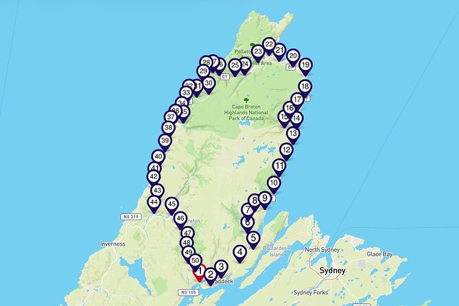
This is not a bus excursion or a guided walk. You use your own car, your own phone or tablet, and your own schedule. The tour begins at Buckwheat Corner, Nova Scotia, and ends back at the meeting point, though the GPS system can still help if you begin at another stop.
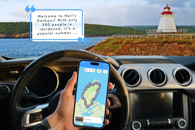
The program uses location triggers to play commentary as you approach points along the route. In practice, the experience is not always perfectly automatic. Some sections have played correctly through Bluetooth in a rental car, while other drivers have needed to start each stop by hand. Treat the app as a helpful co-pilot, not a machine you should trust without checking.
The opening stop is worth playing before you set off. It explains the sounds and alerts used by the audio guide, which makes the rest easier to follow. You may also find short multiple-choice quizzes at some stops. They add a light touch and give passengers something to do while the driver concentrates on the road.
The narration covers far more than scenic viewpoints. It explains what you are seeing, why communities formed where they did, and how the island’s geology shaped the route. That extra context is the real reason to buy this instead of simply following a map.
More self-guided routes in Cape Breton Island:
- Private Self-guided River Rafting Tour in Calgary
★ 5.0 · 182 reviews - Mont-Tremblant: Treetop Observatory and Self-Guided Walk
★ 4.7 · 130 reviews - Icefields Parkway: a Smartphone Audio Driving Tour
★ 4.0 · 118 reviews
Bras d’Or Lake and the island’s early stories
Near the start, the tour introduces Bras d’Or Lake, a long inland sea stretching about 90 kilometres through three finger-like arms. The waterway helps you understand Cape Breton’s shape before the route turns toward the highlands and coast.
The history also begins early. A segment about Alexander Graham Bell explains why the famous inventor has a museum on Cape Breton Island. The Alexander Graham Bell National Historic Site and Museum is close enough to consider as a separate visit, especially if you want more than a passing audio explanation.
The route then moves into the Plaister Mines area, where you hear what was mined there. Mining stories are useful here because they keep the Cabot Trail from becoming only a parade of ocean views. The old workings also make a good reminder that this is a lived-in region, not just a scenic park.
You will hear how Scottish settlers came to Cape Breton and how strongly Scottish culture shaped the island. Later stops return to Acadian and Mi’kmaq stories, giving the route several cultural viewpoints instead of treating the trail as one single heritage story.
Waterfalls, wilderness, and easy walks near the eastern side
Goose Cove Brook is one of the prettiest sections early in the route. Several brooks come together before flowing into a cove, and waterfalls along Goose Cove Brook are accessible for people who want a short nature stop.
The North River Wilderness Area protects more than 5,000 hectares of highland plateau and rugged river valley. You can use this section to stretch your legs on trails suited to different ability levels, or simply listen while looking out over the scenery.
Plaster Provincial Park receives its own commentary as the road passes along its edge. The guide gives facts about the park and the surrounding area, but you should think of this as an orientation rather than a substitute for a full park visit.
The audio also introduces some of Nova Scotia’s largest and roughest protected areas. This is helpful for seeing the Cabot Trail as part of a wider network of highland and coastal wilderness, rather than a single road with isolated attractions.
If you want a practical food stop, the famous roadside business operating since 1976 is worth noting. It sells road-trip supplies and is known for lobster sandwiches. The audio points it out at the useful moment, when a long scenic drive begins to make lunch feel urgent.
Cape Smokey and Ingonish
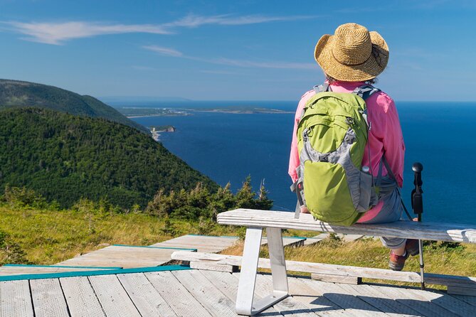
As you climb toward Cape Smokey, a pull-off provides a wide ocean view. The stop is simple but well timed: pause before the final ascent, take in the panorama, and let faster traffic move on.
At the top, Cape Smokey Picnic Park has picnic tables, flush toilets, and scenic lookouts. These facilities matter on a road trip. The Cabot Trail includes long stretches where a comfortable place to stop is more valuable than another dramatic description.
Ingonish is not just one village. The community includes five villages and forms a gateway to Cape Breton Highlands National Park. The area is known for both fresh and saltwater beaches, so it is a sensible place to plan extra time if swimming or shore walks appeal to you.
The tour explains how Ingonish’s two harbours served the Mi’kmaq for more than 9,000 years and continue to support local life and tourism. That is one of the stronger cultural sections because it connects ancient use of the area with the community you see today.
From here, the commentary runs through the local choices in a useful way: trails, whales, golf, and goats. It also points out camping, beaches, and waterfalls. You will not need to stop at every suggestion. The value is having a menu of options while you decide how much time and energy you have.
More audio tours in Cape Breton Island:
- Niagara: Behind The Falls, Skylon Tower Ticket & Tesla Audio Tour
★ 3.5 · 69 reviews - A 7th-Gen Local’s View of Downtown Charlottetown: An Audio Tour
★ 4.5 · 27 reviews - Halifax Churches, Gardens & Graveyards: a Smartphone Audio Walking Tour
★ 4.5 · 25 reviews - Smartphone Audio Driving Tour between Banff and Calgary
★ 4.0 · 25 reviews
Cape Breton Highlands National Park and the mountain roads
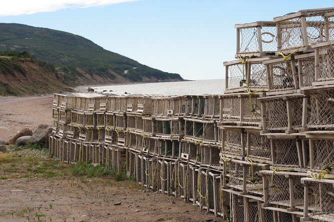
The park is often described as the place where mountains meet the sea. Glaciers and rivers carved the highlands, producing an ecosystem with animals found nowhere else in Nova Scotia. The audio gives enough geology and natural history to make the park’s shape easier to read from the road.
Small communities above the park deserve attention too. Neils Harbour, with about 300 residents, is a tiny fishing village that draws summer visitors. A detour or meal stop here can add local character to a route otherwise dominated by park viewpoints.
The geology becomes especially interesting around the Bras d’Or terrane. The guide describes the area as part of a story involving three continents and explains the collision of continental plates. If you normally skip geology, this may be the section that changes your mind. It gives meaning to the faults, plateaus, and sharply cut valleys around you.
Aspy Bay is a good coastal pause. A red sand bar protects North and South Aspy Bays, creating a broad, attractive shoreline. The Polletts Cove and Aspy Fault Wilderness area carries the geological story further, marking the collision of three continental plates.
For waterfalls, the guide gives directions to one of the park’s more accessible falls, only a couple of kilometres away with a short walk. Check current access before setting out. One outdated recommendation in the route has involved Mary Ann Falls, where the road has been permanently closed to pedestrians and cyclists since 2022. Conditions and access can change, so use the audio as a prompt to verify current details locally.
Skyline, Lone Shieling, and MacIntosh Brook
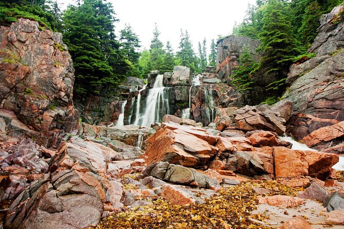
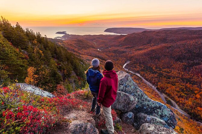
The highland plateaus are the northern end of the Appalachian Mountains, which extend from Florida to Newfoundland. Several roadside lookoffs explain the views, including one with a strong view toward the major fault line cutting through the plateau.
The Lone Shieling is a replica Scottish crofter’s hut reached by a magical 15-minute walk through old sugar maples. Interpretive panels explain the hut once you arrive. This is a small stop, but it ties the scenery to the Scottish settlement story heard earlier.
MacIntosh Brook offers a longer but still manageable family walk. The trail takes about 30 minutes and follows a babbling brook to a woodland waterfall. It is suitable for the whole family and for dogs, making it one of the most practical suggestions on the route.
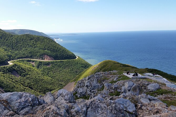
Skyline Trail is the postcard stop. From the end of the trail, you get the famous view of the Cabot Trail winding along French Mountain beside the Gulf of St. Lawrence. The path is well groomed and rated an easy walk, but it still takes time. Do not squeeze it into a schedule built around the four to five hours of audio. The walking, photo stops, and return drive need their own allowance.
The tour also points out French Lake, where a roadside pull-off looks across a highland lake surrounded by boreal forest. This is an easy stop for anyone who wants the scenery without a hike.
Pleasant Bay, whales, moose, and ocean lookoffs

Pleasant Bay is called the whale watching capital of Cape Breton. The audio gives you the setting and points toward activities in the area, but a separate whale-watching outing would require its own booking and schedule.
Several lookoffs provide the kind of quick stops that make a driving tour work. One opens toward the Gulf of St. Lawrence, while the Fishing Cove Trail entrance gives a view of mountain headlands sweeping down to the ocean.
Moose are another local theme. Cape Breton’s moose have an interesting history, and the tour identifies a spot where these large animals may feed on forest herbs and aquatic plants near a lake. The wording is important: this is a possibility, not a wildlife guarantee. Keep your eyes on the road and do not stop unsafely.
The route also includes a history walk through a former Acadian settlement. At one time, 30 Acadian families lived in the area, including refugees from the 1755 expulsion in Nova Scotia. Le Buttereau, meaning little hill, was once home to seven Acadian families. These stops help connect the quiet roads and fields with the people who lived here before the modern tourist route.
The Cheticamp River marks the western entrance to the national park. There is a campground and four nearby trails, including Le Chemin du Buttereau. A gravel and sand arm sweeps from the red bluffs across the tidal estuary, almost closing the river off from the sea. It is an excellent example of how water and rock shape this coast.
Cheticamp and the Acadian coast

Cheticamp is one of the world’s Acadian capitals and a practical base for food, museums, whale watching, golf, and other services. If the park section has left you ready for a proper break, this is one of the better places to pause.
For a sandy beach, Plage St. Pierre on Cheticamp Island offers a beach and campground. The audio also introduces Mi-carême, an Acadian tradition involving masks and celebration. If you have extra time, the Centre de la Mi-carême lets you learn more and make your own mask.
As the route continues south, the highlands flatten and the Gulf of St. Lawrence opens out. The coastal water here is part of the Cape Breton Trough, a marine environment with unusual depth and productive waters.
Belle Cote means beautiful coast, and the name makes sense when you take Belle Cote Beach Road toward the shore. This is the kind of detour an audio guide earns its price by revealing. Without a prompt, you could easily stay on the main road and miss a smaller coastal turn.
Margaree Valley, fishing, and the final stops
Crossing Margaree Harbour can feel like crossing a lake. The Margaree River estuary is nearly a kilometre wide, so the scale is surprising from the bridge.
At East Margaree Crossing, the bridges give a good view of the river winding along the valley floor. You might see a fisher in waders casting in the shallows. Nearby, the Margaree Salmon Museum and Margaree Fish Hatchery add an angling focus to the final section.
The surrounding hills are part of the Appalachian range. A picnic park beside the road gives views across the lake toward low mountains and makes a pleasant, romantic place to pause.
For something more active, Live Life in Tents River Tours offers camping from primitive sites to glamping, along with river trips through rapids. These are recommended possibilities, not included activities, so check availability and book separately.
Near the end, another old mine appears in the hills beyond the fields. The guide asks you to guess what was mined there, a small quiz-like moment that keeps passengers engaged.
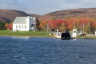
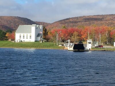
The final unusual sight is a pair of churches standing side by side. Their white clapboard walls and grey spires look almost alike, and the audio explains how they came to share this setting. It is a fitting finish: a small human story after hours of geology, coast, forest, and mountain views.
Is $9 good value for your car?
At $9 per group, this is one of the cheapest ways to add structure to a Cabot Trail drive. A family of four pays less than the cost of many single museum admissions, while a group of 10 or 15 gets especially strong value.
The price works because you provide the car, fuel, phone, and sightseeing time. You are not paying for a driver, reserved seats, meals, park admissions, hikes, whale watching, or other attractions. Still, the guide can help you find stops you might otherwise pass, which may save time and prevent missed opportunities.
I would buy it for a first visit, especially if you want historical context and trail ideas without joining a fixed group. I would be less enthusiastic if you only want a quiet drive or already have a detailed route plan from a local source.
How to make the app work well
Download the complete tour on reliable WiFi before reaching Buckwheat Corner. Do not assume that seeing the map means all audio and photos are stored. Run through the tutorial first and test the playback.
Connect your phone to the vehicle by Bluetooth if possible. Set everything up before driving, and let a passenger handle manual playback if needed. Using a phone in your hand while driving is illegal in Canada, so the driver should never troubleshoot while moving.
Start with the first stop if you can. If you begin elsewhere, the GPS may adjust to your position, but directional wording can become confusing. Driving clockwise has worked for some users, but it may require manually starting each item and can place references to the right and left on the wrong side for your direction.
Keep a paper or downloaded backup of your key stops. Signal can vanish, and access to trails or roads can change. The audio tour is useful guidance, but it should not replace current local signs.
Who should book it?
This tour suits families, couples, friend groups, and anyone sharing a rental car. It is especially good for independent drivers who want commentary but dislike fixed departure times. Dog owners may appreciate the suggestions for walks such as MacIntosh Brook, though trail rules still apply.
It also works for a partial route. If your schedule is short, use the guide for one section and return to the rest later. Since the tour is yours to keep, it has more value than a one-use recording tied to a strict departure.
The main audience I would caution is the low-tech user who cannot prepare downloads in advance. The setup has frustrated some people, and automatic playback is not guaranteed at every stop. If you are comfortable with a smartphone and willing to test the app before driving, the risk is manageable.
FAQ
How much does the Cabot Trail smartphone audio tour cost?
The tour costs $9 per group, with one booking covering up to 15 people in one vehicle.
How long does the audio tour take?
The approximate duration is four to five hours. Extra time is needed for hikes, beaches, viewpoints, meals, museums, and other stops.
Do I need cell service during the drive?
No signal or mobile data is required during the tour after the complete download. A good mobile or WiFi connection is needed for the initial download.
Where does the tour start and end?
The listed start point is Buckwheat Corner, Nova Scotia, B0E 1B0. The activity ends back at the meeting point.
Can I use the tour on another date?
Yes. The tour has flexible dates and remains yours to keep and use anytime through Tripvia Tours.
Do I need my own vehicle?
Yes. Transportation is not included, and you use your own vehicle for the driving tour.
Can I start at a different stop?
Yes, you can start at another stop, but the audio may require manual playback and directional references may be less accurate if you drive the route in the opposite direction.
Is a smartphone or tablet included?
No. You must provide your own smartphone or tablet.
Can I cancel for a full refund?
You can cancel for a full refund at least 24 hours before the experience start time. Cancellations or changes made within 24 hours are not accepted and are not refunded.
Should you book this Cabot Trail tour?
I would book it if you want the Cabot Trail to feel like more than a beautiful road. The guide adds stories about Mi’kmaq use, Scottish settlement, Acadian communities, mines, continental plates, wildlife, and the people who still live along the route.
Buy it before your drive, download every part on WiFi, test the tutorial, and keep your schedule loose. For $9 per car, it is a smart companion for a first visit, provided you accept that the technology may occasionally need a nudge.
Just added around Cape Breton Island
- Sydney Food Tasting Tour★ 5.0 · 9 reviews
- Cape Breton Scenic Jeep Adventure★ 5.0 · 14 reviews
- Cabot Trail Jeep Adventure – Cruise Excursion★ 5.0 · 5 reviews
- Private Cabot Trail Discovery Tour★ 5.0 · 18 reviews
- Cape Breton Jeep Adventure (4hr)★ 5.0 · 6 reviews
- UTV/Side-by-Side Trail Tour to Cape Clear Look-off★ 5.0 · 32 reviews
- Shared Cruise Excursion – “Mini” Cabot Trail★ 4.5 · 58 reviews
- Private Port of Sydney-Cape Breton Highlands ATV Excursion★ 4.5 · 5 reviews
Cape Breton Island Tours, compared.


Blackwood Tours: Highland Village, Baddeck, Bell Museum Tour
Read our review →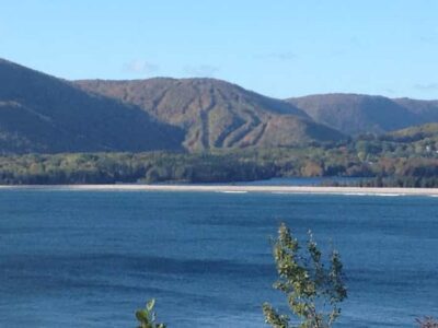
Fortress of Louisbourg Driving Tour from Sydney Nova Scotia
Read our review →
Sydney: Highland Village & Bell Museum Cruise Excursion
Read our review →Browse the lists this tour appears in